14.31.140 Appendix.
(1) Land Use Conflicts. The matrix indicates the conflicts that are presumed to exist between land uses. The types of mitigation measures listed in the following Sections are the design tools that may be employed either separately or in combination to mitigate existing or potential land use conflicts. Minimum Performance Standards require that such conflicts be mitigated as a condition for approval of the development plan.
(a) Land Use Conflict Mitigation Measures
(i) Open Space Setbacks. By providing an open space buffer between conflicting land uses conflicts can often be avoided. The width of the buffer required will depend on the extent of landscaping. To work effectively, the ownership, use, and maintenance of the open space buffer must be clearly defined.
(ii) Landscaping and Topographic Changes. As part of an open space buffer or as a treatment of land immediately adjacent to buildings, landscaping can be used to reduce conflicts.
(A) Dense plantings of evergreens can provide a visual buffer.
(B) Sensitive landscaping can soften the sharp visual contrast between two (2) abutting land uses by subduing the differences in architecture and bulk and by providing a gradual transition rather than a harsh edge between uses.
(C) Dense growth of plants can be visually appealing but also can be inhospitable to unwanted travelers. Such natural screen can discourage unwanted and unsafe pedestrian or bicycle access between land uses.
(D) Good landscaping can help other mitigation measures. It can reduce the width of open space buffer required. It can soften the visual conflict created by safety and security fences.
(E) Recontouring of the land can alter views, subdue sounds, change the sense of proximity, and channel pedestrian travel.
(iii) Orientation. The strict spatial proximity between land uses and the apparent or functional proximity can be very different depending on the orientation of buildings and activities of the two (2) land uses.
(A) The buildings themselves can cause a buffer to be created by effectively turning their backs on each other – orienting views, access and principal activities away from the other land use. Care must be taken, however, that a hazardous and unaesthetic “no-mans’s land” is not created in the process. Some appropriate use must be given to the intervening space. Alternately, the intervening space can be eliminated altogether if the two (2) buildings share a common back wall. An entire site plan can be oriented so that the activities and functions are aligned hierarchically – placing those least compatible furthest from the common boundary between land uses and those most compatible near that boundary.
(iv) Barriers and Alleviation. It may be appropriate and necessary to use physical barriers to prevent the undesirable attributes of one land use from affecting the people and activities in the adjacent land use. Fences, walls and berms can prevent the passage of people into areas that would be unsafe or insecure. They can also prevent spillage of materials from one (1) site to another. Noise, light, and odor pollution can be reduced at the point of origin by modifying the normal design of the operations causing the pollution. Light and noise can also be mitigated through physical barriers such as fences, walls, berms, screens and landscaping.
(v) Architectural Compatibility. In addition to the architectural considerations involved in mitigation through orientation, the materials, colors, scale, and prominence of buildings in adjacent land uses can be coordinated so there is a gradual transition from one (1) land use to another rather than a sharp and displeasing contrast. Purely aesthetic details that are “tacked” onto a building to cover up land use conflicts, however, will cause more harm than good. The architectural compatibility should rise from a total consideration of the function of each land use and the function of the space between them.
(vi) Circulation. Streets and parking areas can often serve to reduce certain types of land use conflicts.
Figure 14.31.070. Density Determination.
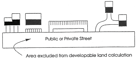
Figure 14.31.080(a). Fence Height.
.png)
Figure 14.31.080(b). Visual Relief.
.png)